Reading view

There are new articles available, click to refresh the page.

A record of the Earth’s temperature covering half a billion years
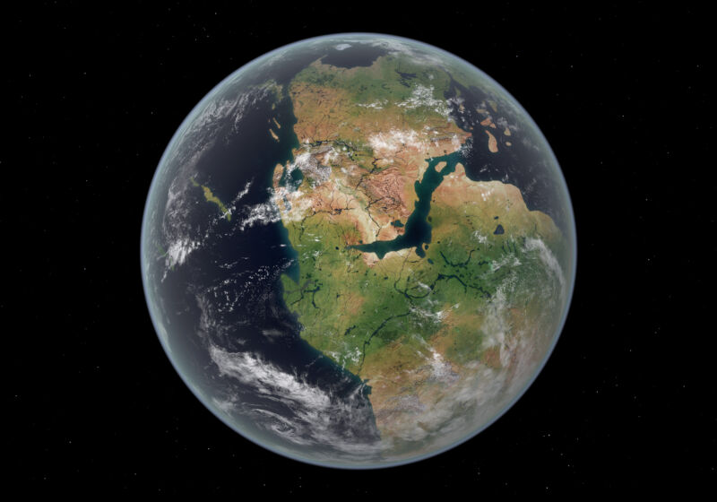
Image of the Earth with a single, enormous land mass composed of several present-day continents.

Enlarge / The cycle of building and breaking up of supercontinents seems to drive long-term climate trends. (credit: Walter Myers/Stocktrek Images)

Global temperature records go back less than two centuries. But that doesn't mean we have no idea what the world was doing before we started building thermometers. There are various things—tree rings, isotope ratios, and more—that register temperatures in the past. Using these temperature proxies, we've managed to reconstruct thousands of years of our planet's climate.

But going back further is difficult. Fewer proxies get preserved over longer times, and samples get rarer. By the time we go back past a million years, it's difficult to find enough proxies from around the globe and the same time period to reconstruct a global temperature. There are a few exceptions, like the Paleocene-Eocene Thermal Maximum (PETM), a burst of sudden warming about 55 million years ago, but few events that old are nearly as well understood.

Now, researchers have used a combination of proxy records and climate models to reconstruct the Earth's climate for the last half-billion years, providing a global record of temperatures stretching all the way back to near the Cambrian explosion of complex life. The record shows that, with one apparent exception, carbon dioxide and global temperatures have been tightly linked. Which is somewhat surprising, given the other changes the Earth has experienced over this time.

Read 13 remaining paragraphs | Comments

Evidence of “snowball Earth” found in ancient rocks

Image of a white planet with small patches of blue against a black background.

Enlarge / Artist's conception of the state of the Earth during its global glaciations. (credit: NASA)

Earth has gone through many geologic phases, but it did have one striking period of stasis: Our planet experienced a tropical environment where algae and single-celled organisms flourished for almost 2 billion years. Then things changed drastically as the planet was plunged into a deep freeze.

It was previously unclear when Earth became a gargantuan freezer. Now, University College London researchers have found evidence in an outcrop of rocks in Scotland, known as the Port Askaig Formation, that show evidence of the transition from a tropical Earth to a frozen one 717 million years ago. This marks the onset of the Sturtian glaciation and would be the first of two "snowball Earth" events during which much of the planet’s surface was covered in ice. It is thought that multicellular life began to emerge after Earth thawed.

Found in the Scottish islands known as the Garvellachs, this outcrop within the Port Askaig Formation is unique because it offers the first conclusive evidence of when a tropical Earth froze over—underlying layers that are a timeline from a warmer era to a frigid one. Other rocks that formed during the same time period in other parts of the world lack this transitional evidence because ancient glaciers most likely scraped it off.

Read 12 remaining paragraphs | Comments

How did volcanism trigger climate change before the eruptions started?

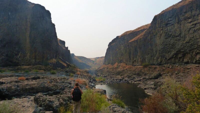
Image of a person in a stream-filled gap between two tall rock faces.

Enlarge / Loads of lava: Kasbohm with a few solidified lava flows of the Columbia River Basalts. (credit: Joshua Murray)

As our climate warms beyond its historical range, scientists increasingly need to study climates deeper in the planet’s past to get information about our future. One object of study is a warming event known as the Miocene Climate Optimum (MCO) from about 17 to 15 million years ago. It coincided with floods of basalt lava that covered a large area of the Northwestern US, creating what are called the “Columbia River Basalts.” This timing suggests that volcanic CO2 was the cause of the warming.

Those eruptions were the most recent example of a “Large Igneous Province,” a phenomenon that has repeatedly triggered climate upheavals and mass extinctions throughout Earth’s past. The Miocene version was relatively benign; it saw CO2 levels and global temperatures rise, causing ecosystem changes and significant melting of Antarctic ice, but didn’t trigger a mass extinction.

A paper just published in Geology, led by Jennifer Kasbohm of the Carnegie Science’s Earth and Planets Laboratory, upends the idea that the eruptions triggered the warming while still blaming them for the peak climate warmth.

Read 32 remaining paragraphs | Comments

Natural piezoelectric effect may build gold deposits

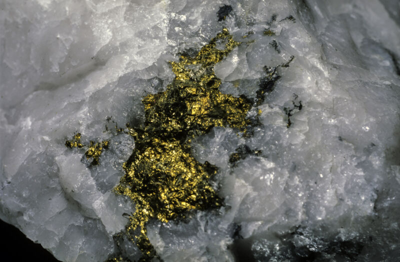
Image of a white rock with gold and black deposits speckled throughout it.

Enlarge / A lot of gold deposits are found embedded in quartz crystals. (credit: Pierre Longnus)

One of the reasons gold is so valuable is because it is highly unreactive—if you make something out of gold, it keeps its lustrous radiance. Even when you can react it with another material, it's also barely soluble, a combination that makes it difficult to purify away from other materials. Which is part of why a large majority of the gold we've obtained comes from deposits where it is present in large chunks, some of them reaching hundreds of kilograms.

Those of you paying careful attention to the previous paragraph may have noticed a problem here: If gold is so difficult to get into its pure form, how do natural processes create enormous chunks of it? On Monday, a group of Australian researchers published a hypothesis, and a bit of evidence supporting it. They propose that an earthquake-triggered piezoelectric effect essentially electroplates gold onto quartz crystals.

The hypothesis

Approximately 75 percent of the gold humanity has obtained has come from what are called orogenic gold deposits. Orogeny is a term for the tectonic processes that build mountains, and orogenic gold deposits form in the seams where two bodies of rock are moving past each other. These areas are often filled with hot hydrothermal fluids, and the heat can increase the solubility of gold from "barely there" to "extremely low," meaning generally less than a single milligram in a liter of water.

Read 11 remaining paragraphs | Comments

The Earth heated up when its day was 22 hours long

The Earth heated up when its day was 22 hours long

Enlarge (credit: Roman Studio)

Because most things about Earth change so slowly, it's difficult to imagine them being any different in the past. But Earth's rotation has been slowing due to tidal interactions with the Moon, meaning that days were considerably shorter in the past. It's easy to think that a 22-hour day wouldn't be all that different, but that turns out not to be entirely true.

For example, some modeling has indicated that certain day lengths will be in resonance with other effects caused by the planet's rotation, which can potentially offset the drag caused by the tides. Now, a new paper looks at how these resonances could affect the climate. The results suggest that it would shift rain to occurring in the morning and evening while leaving midday skies largely cloud-free. The resulting Earth would be considerably warmer.

On the Lamb

We're all pretty familiar with the fact that the daytime Sun warms up the air. And those of us who remember high school chemistry will recall that a gas that is warmed will expand. So, it shouldn't be a surprise to hear that the Earth's atmosphere expands due to warming on its day side and contracts back again as it cools (these lag the daytime peak in sunlight). These differences provide something a bit like a handle that the gravitational pulls of the Sun and Moon can grab onto, exerting additional forces on the atmosphere. This complicated network of forces churns our atmosphere, helping shape the planet's weather.

Read 13 remaining paragraphs | Comments

Saturn’s moon Titan has shorelines that appear to be shaped by waves

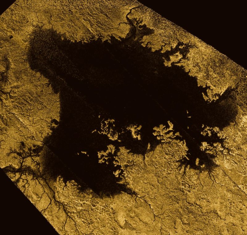
Ligeia Mare, the second-largest body of liquid hydrocarbons on Titan.

Enlarge / Ligeia Mare, the second-largest body of liquid hydrocarbons on Titan. (credit: NASA/JPL-Caltech/ASI/Cornell)

During its T85 Titan flyby on July 24, 2012, the Cassini spacecraft registered an unexpectedly bright reflection on the surface of the lake Kivu Lacus. Its Visual and Infrared Mapping Spectrometer (VIMS) data was interpreted as a roughness on the methane-ethane lake, which could have been a sign of mudflats, surfacing bubbles, or waves.

“Our landscape evolution models show that the shorelines on Titan are most consistent with Earth lakes that have been eroded by waves,” says Rose Palermo, a coastal geomorphologist at St. Petersburg Coastal and Marine Science Center, who led the study investigating signatures of wave erosion on Titan. The evidence of waves is still inconclusive, but future crewed missions to Titan should probably pack some surfboards just in case.

Troubled seas

While waves have been considered the most plausible explanation for reflections visible in Cassini’s VIMS imagery for quite some time, other studies aimed to confirm their presence found no wave activity at all. “Other observations show that the liquid surfaces have been very still in the past, very flat,” Palermo says. “A possible explanation for this is at the time we were observing Titan, the winds were pretty low, so there weren’t many waves at that time. To confirm waves, we would need to have better resolution data,” she adds.

Read 9 remaining paragraphs | Comments

❌